|
Chapter 1: A Survey of GIS for Disaster Management |
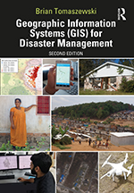
This is the companion website for Chapter 1: A Survey of GIS for Disaster Management from the book Geographic Information Systems (GIS) for Disaster Management (second edition). This page contains links to any technical video walk throughs contained in the chapters, slides for the chapters, chapter test questions, and other additional materials.
Chapter Abstract
This chapter provides a survey of survey of Geographic Information Systems (GIS) for disaster management. First discussed is the critical role of GIS is for understanding the geographical context of disaster situations and supporting situation awareness. The continued need for GIS in disaster management is illustrated by problems such as natural disasters, climate change, humanitarian crisis, global pandemics, and forced displacement using case studies such as Hurricane Harvey, and the Rohingya, Syrian, and Congolese refugee crisis, and COVID-10 pandemic. Conversely, the chapter also discusses opportunities that exist in of GIS for disaster management through increased awareness and advocacy of GIS and mapping via increased acceptance and availability of technologies such as open source GIS, 3D GIS, open data, web GIS, and artificial intelligence and machine learning. A final discussion is made on spatial thinking as disasters are inherently spatial problems – the interactions between people, the places they live, the environments that surround them, the events that affect them, the broader networks of support that are drawn upon are all multi-scale space/time phenomena that must be considered in any aspect of disaster management. The chapter concludes with technical exercise focused on compiling and critically examining disaster management maps to understand how maps provide geographic context.
Chapter Objectives: Upon chapter completion, readers should be able to:
- understand the role of maps in disaster management;
- describe how maps provide geographic context for disaster management and recognize how geographic information systems (GIS) can be used for understanding geographic context;
- be familiar with the concept of situation awareness;
- discern the problems associated with the continued need for GIS in disaster management;
- recognize the opportunities that exist with continued awareness and advocacy of GIS and mapping for disaster management;
- understand the importance of spatial thinking in disaster-management practice.
Follow these links to access Chapter 1: A Survey of GIS for Disaster Management materials:
- Chapter 1 Slides (.pptx, 5.87 mb)
- Chapter 1 Test Bank (.docx, 19 kb) | Chapter 1 Test Bank (.pdf, 142 kb)
For information on this chapter, purchase the book from Routledge Press »