|
Chapter 5: Disaster Management and Geographic Information Systems |
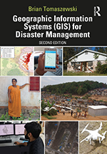
This is the companion website for Chapter 5: Disaster Management and Geographic Information Systems from the book Geographic Information Systems (GIS) for Disaster Management (second edition). This page contains links to any technical video walk throughs contained in the chapters, slides for the chapters, chapter test questions, and other additional materials.
Chapter Abstract
This chapter explores the relationship between Geographic Information Systems (GIS) and the disaster management application domain with no disaster management background assumed. The disaster management cycle concept (preparedness/planning, response, recovery, mitigation) is presented with the relationship between specific disaster phases and GIS addressed at length in subsequent chapters. The role of GIS within US disaster management policy is discussed via topics such as the National Incident Management System (NIMS) and the Incident Command System (ICS), and the United States Homeland Security Enterprise Geospatial Concept of Operations (HSE GeoCONOPS). GIS use in city, town, and county governments and the private sector is discussed as well as Federal agencies like the Federal Emergency Management Agency (FEMA). The second half of the chapter focuses on international organizations and mechanisms for disaster management through discussion of groups that include but are not limited to Map Action, Humanitarian OpenStreetMap Team, and policies such as the Sendai Framework for Disaster Risk Reduction. Global perspectives on GIS and disaster management are next discussed via case studies from Europe, Asia, Africa, and Latin America. United Nations organizations that utilize GIS for disaster management are also discussed. The chapter concludes with a technical exercise on accessing humanitarian datasets from multiple organizations.
Chapter Objectives: Upon chapter completion, readers should be able to:
- discern the difference between different disaster management terms;
- understand different disaster management cycle components;
- understand the role of geographic information systems (GIS) within different disaster management policies and jurisdictional levels;
- understand how international disaster management operates and the various organizations and mechanisms involved in international disaster management.
Follow these links to access Chapter 5: Disaster Management and Geographic Information Systems materials:
- Chapter 5 Slides (.pptx, 4.01 mb)
- Chapter 5 Test Bank (.docx, 20 kb) | Chapter 5 Test Bank (.pdf, 143 kb)
For information on this chapter, purchase the book from Routledge Press »