|
Chapter 4: Geographic Information Systems and Allied Technologies |
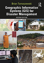
This is the companion website for Chapter 4: Geographic Information Systems and Allied Technologies from the book Geographic Information Systems (GIS) for Disaster Management (second edition). This page contains links to any technical video walk throughs contained in the chapters, slides for the chapters, chapter test questions, and other additional materials.
Chapter Abstract
This chapter discusses four technologies critical to spatial aspects of GIS for disaster management - Global Positioning Systems (GPS), Unmanned Aerial Systems (UAS) or “drones”, remote sensing, and indoor navigation and positioning. GPS basics are covered through discussion of GPS Segments, GPS trilateration, and GPS accuracy and causes of positional GPS inaccuracy. UAS are a significant new development for disaster management. UAS platforms are discussed as well as combining UAS with GIS tools and UAS disaster management applications. Remote sensing is integral to GIS for disaster management through acquiring images without being in physical contact with an object being observed. For example, satellite images of a wildfire. Remote sensing topics discussed include electromagnetic energy, transmissivity, spectral response patterns or signatures, spatial resolution, spectral resolution, radiometric resolution, temporal resolution, differences between passive and active remote sensing, and change detection. Remote sensing product examples along with discussion on international remote sensing disaster support mechanisms is provided. Indoor navigation and positioning, critical to disaster response, is the tracking locations of people or objects inside of buildings using 3D maps, WiFi beacons and other approaches. The chapter concludes with a technical exercise on obtaining free remote sensing imagery (Landsat) from USGS Earth Explorer.
Chapter Objectives: Upon chapter completion, readers should be able to:
- describe (1) the different segments of GPS, (2) the basic ideas of how GPS provides a location on the earth’s surface, and (3) causes of GPS receiver inaccuracy and methods for improving GPS receiver accuracy;
- explain basic principles of Unmanned Aerial Systems (UAS) for emergency management;
- identify legal and privacy issues with UAS;
- describe basic principles of remote sensing;
- identify commonly used remote-sensing products;
- describe international disaster management remote-sensing mechanisms;
- describe important ideas with indoor navigation.
Follow these links to access Chapter 4: Geographic Information Systems and Allied Technologies:
- Chapter 4 Slides (.pptx, 4.6 mb)
- Chapter 4 Test Bank (.docx, 20 kb) | Chapter 4 Test Bank (.pdf, 143 kb)
For information on this chapter, purchase the book from Routledge Press »